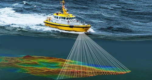
Hydrographic Survey Equipment
Best Hydrographic Survey Equipment Yemen

Benefits of our Hydrographic Survey Equipment Yemen
- Advanced Technology: We have made it possible for our technology to be used in all different types of operations, which range from marine resource management through to frontiers of science and research projects that you can think of.The objective of completely repeatable data collection is realized by sophisticated devices such as sonar systems, multibeam echosounders, and sub-bottom profilers.
- Comprehensive Solutions: Hydrographic survey equipment Yemen that is available with us can be made specific to the different requirements of the various industries that may include marine constructions, environmental surveys, oil and gas exploration and production, and maintenance of ports and harbors.
- Expert Support: To meet your specific requirements, you will be advised by a team of experts who understand the hydrographic survey equipment yemen from close to first hand considering that they have been practicing it for a long time. Our goal and vision is to make sure that you get only the right solution for your project in the most efficient way possible.
- Maintenance and Repair Services: We offer full-time technician services for fixing & maintaining devices used in hydrographic survey equipment yemen, thereby keeping them in a good working condition while also saving them from breaking down.
Hydrographic Survey yemen
Importance of Hydrographic Survey Yemen
For many reasons, hydrographic surveys Yemen are essential. They are an important factor in marine navigation safety provision due to providing elaborate navigation charts that can guide vessels safely through places with submerged perilous items. In addition, these surveys are significant for environmental monitoring as they provide data on water depths, sediment type and distribution, and sea bottom configurations needed to determine any changes occurring in oceanic ecosystems and take protective actions. Hydrographic survey Yemen provides crucial preconditions for resource exploration by creating detailed maps of the underwater topography and underground formations. This paper highlights the role of hydrographic surveys in the safe extraction of oil, gas and other minerals from the seabed. Apart from this, hydrographic survey yemen serve as vital tools in coastal and harbor development involving planning, construction, sediment transport comprehension and management of erosion.

